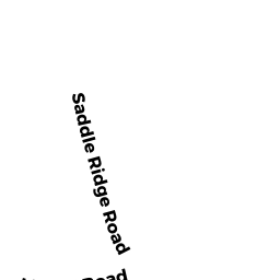
9 SADDLE RIDGE RD
Owner Information
KOLLIGIAN KRISTIAN + PAGE M
9 SADDLE RIDGE RD
DOVER, MA 02030


Property Details
9 SADDLE RIDGE RD is classified as a Single Family Residential (Colonial).
The primary structure on this property was built in 1966. There are 4,170ft2 of built area within this property. There is 4,170ft2 of residential/living space within this property. This property is listed as having 11 rooms.
9 SADDLE RIDGE RD is valued at $947,800. The land is valued at $576,500 and the structures are valued at $371,300.
This property is in Zone R1. Confirm with local Zoning Board authorities to ensure there are no overlays or other easements on this property.
The most recent deed for 9 SADDLE RIDGE RD is recorded at the local registrar in Book 16247, Page 495. 9 SADDLE RIDGE RD was last sold on Tuesday, February 19, 2002 for $815,000.
Assessment data from fiscal year 2022.
Flood Data
According to the FEMA National Flood Hazard Layer, this property does not appear to be in a flood zone. It may also be in an area not yet reviewed. Nonetheless, confirm this information prior to taking any action.
To view the flood hazards around this property, create a FEMA "Firmette" Map of the area around 9 SADDLE RIDGE RD.
Broadband Internet Providers
| Provider | Type | Bandwidth (mbps) | |
|---|---|---|---|
| Viasat Inc | Satellite | 100 | 3 |
| VSAT Systems, LLC. | Satellite | 2 | 1 |
| HughesNet | Satellite | 25 | 3 |
| GCI Communication Corp. | Satellite | 0 | 0 |
| Comcast | Cable | 1000 | 35 |
| Verizon New England Inc. | DSL | 5 | 0 |
| Verizon New England Inc. | Fiber | 940 | 880 |
Broadband service provider data from December 2020.
Adjacent Properties
- 0 WILSON`S WAY
Undevelopable Residential Land owned by BISSON STEPHEN W - 0 OFF HARTFORD ST
Land - integral part of manufacturing operation owned by COLONIAL WATER COMPANY - 11 SADDLE RIDGE RD
Single Family Residential owned by FATTORE DAWN M - 7 SADDLE RIDGE RD
Single Family Residential owned by THOMPSON CAROLYN N TRUSTEE - 28 FRANCIS ST
Single Family Residential owned by SPRINGETT ROBERT P - 0 OFF SADDLE RIDGE RD
Potentially Developable Residential Land owned by GLADITSCH PETER E + JANE